innovation
High-altitude platforms: Flying beyond the tropopause
One day, ultralight aircraft with an enormous wingspan are set to document changes on the Earth’s surface and improve telecommunications.
author: Monika Weiner | 8 mins reading time published on: 09.01.2024
author:
Monika Weiner
has been working as a science journalist since 1985. A geology graduate, she is especially interested in new developments in research and technology, and in their impact on society.
©DLR
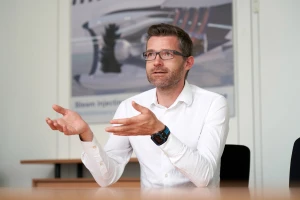
“Only through advances in solar and battery technology has it become possible to design solar-electric aircraft capable of generating and storing enough energy to reach very high layers of the atmosphere and stay up there for several days and nights”.
Head of the HAP-alpha project at DLR
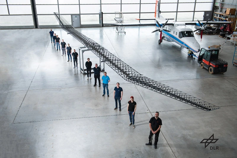
To test the 27 meters of wing (roughly the wingspan of an Airbus A320), the team at the German Aerospace Center (DLR) needs a lot of space. That is why the bending tests for this lightweight construction take place in the massive hangar at the DLR site in Stade. A specially designed structure allows the engineers to lift the 35-kilogram wing several meters into the air and simulate the forces that occur in flight.
In real life, the wings are pushed upward during gliding. Since these upward forces are difficult to simulate on the ground, the wing is mounted on the structure with the top facing down and weights are applied for the bending test. That way, the downward gravitational force simulates the uplift forces, pulling the wing tips down roughly two meters toward the ground. The engineers use a laser to determine the exact distance before checking for microcracks potentially caused by the load. In the air, such cracks would have disastrous consequences.
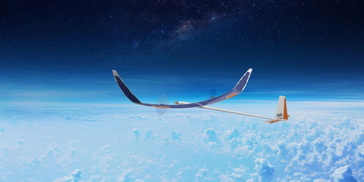
Two years from now, this wing is set to lift DLR’s first high-altitude platform (HAP) into the air. At first glance, the design team’s construction sketch is reminiscent of a glider. That’s no accident—after all, the HAP is designed to be an extremely energy-efficient super glider capable of generating lift even at an altitude of 20 kilometers. The HAP is powered by two electric motors with a peak power of 2.5 kilowatts each. Solar cells on the wing’s upper surface supply the necessary electricity.
©DLR
Wingspan of a narrowbody: Its enormous dimensions become clear once the construction team stands underneath. The lightweight wing is 27 meters long—roughly the wingspan of an Airbus A320.
“Only through advances in solar and battery technology has it become possible to design solar-electric aircraft capable of generating and storing enough energy to reach very high layers of the atmosphere and stay up there for several days and nights,” explains Florian Nikodem, head of the HAP-alpha project at DLR. “The stratosphere, which begins at an altitude of roughly 18 kilometers, beyond commercial airspace, is peculiar in a number of ways: There are no clouds, no weather. The air tends to be calm, clear, and thin. These are ideal conditions for observing the Earth. At the same time, building a high-altitude platform that can fly this high and return safely to the ground poses an enormous technological challenge.”
High stability is the way forward
Before HAP alpha can take off, it has to undergo a series of tests. The bending test carried out at DLR in Stade is just one of them. A ground vibration test for the entire aircraft is scheduled for next year. The engineers want to use these measurements to back up the analytical models on which the design is based.
Strong squalls, or even storms, pose the biggest threat to HAP-alpha: the ultralight aircraft is supposed to weigh only 136 kilograms. The platform is primarily designed to soar through the stratosphere’s thin air, where turbulence is rare. “What’s dangerous, however, is the flight to get there and back down to Earth,” Nikodem says. “Ascent and descent take many hours, during which the platform is exposed to the elements. Although we consult all available forecasts and fly only in ideal conditions, we have to expect the weather to suddenly change during the flight.” That is why a stable design is critical for a successful mission.

©NASA Photo / Carla Thomas


©NASA Photo / Carla Thomas
Helios prototype: Developed by NASA, the solar-powered HAP achieved the world record for maximum altitude in 2001, when it stayed at 29,413 meters in the air for 40 minutes.
©NASA Photo / Carla Thomas
Ever longer, ever higher: The race of the stratosphere gliders
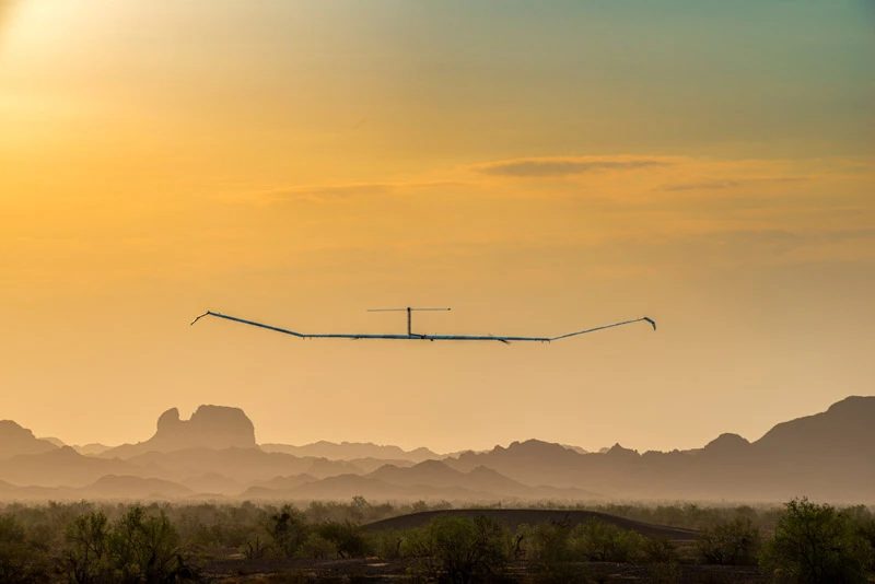
High-altitude platforms have entered the stratosphere over a dozen times, with Airbus holding the record for the longest successful mission: the flight of the Zephyr S lasted 26 days. The unmanned solar-electric aircraft took off in Arizona on August 6, 2018, and safely returned to Earth after completing its mission. While one of its successor models, the Zephyr 8, broke this record—the platform cruised through the stratosphere for a full 64 days—it ended up crashing. The world record for the highest altitude was set by NASA’s solar-powered HAP, Helios, in 2001. Fitted with solar cells and 14 electric motors, this 580-kilogram giant ascended to an altitude of 29,413 meters.
The race for ever longer and ever higher flights is fueled by the vision of one day revolutionizing Earth observation with a network of high-altitude platforms. At present, geodesists, glaciologists, climate scientists, and disaster management officers rely on aircraft- and satellite-aided measurements to help them look for leaks in pipelines or determine things like the movement of weather fronts or forest fires, the thickness of the ice on waterways, the pace at which glaciers calve, changes in the air quality in particular regions of the planet, and the migration routes of herds of animals.
But observation time is limited. Aircraft can circle above a given place for no more than a couple of hours, and most satellites used in remote sensing aren’t geostationary, meaning they move relative to the Earth so the time they can keep their focus on any particular place is limited. This makes it difficult to obtain detailed long-term measurements. Unmanned solar-electric aircraft could fill this gap: they can circle above the same region for days or even weeks, collect data, and send it back to Earth.
For telecommunications, too, high-altitude platforms open up new possibilities. Flying at enormous altitudes allows HAPs to establish radio contact across large areas. NASA’s Sunglider, a solar aircraft that is powered by ten electric motors and resembles a gigantic wing, can cover an area of 200 square kilometers, for instance. This makes HAPs a compelling alternative to satellite-aided telecommunications.
©Christian Otto 2021
Long-term record of the Airbus model: To date, Zephyr is the only fixed-wing HAP that has been shown to survive day and night in the stratosphere. Its record is 64 days.
Flying high for science
Various research and industrial companies have developed a whole range of HAPs. “But we don’t see them as competitors,” Nikodem says. “Our goal is to generate knowledge. It’s our job as a German research institution to support industry. That’s why we’re focusing on setting up a testing platform to help DLR as well as companies develop and test new technologies such as new propulsion technologies, sensors, measurement electronics, and telecommunications.”
Much research and development work still needs to go into DLR’s HAP mission. Materials have to be found that are ultralight yet stable, such as carbon-fiber-reinforced polymers, for example for the ribs and longerons, or highly UV-resistant films for covering the wings. What’s more, to be able to ascend to an altitude of 20 kilometers and stay in the air for several days requires extremely powerful batteries. These have to not only supply sufficient power for takeoff, but also store enough energy during sunshine hours when light hits the solar cells so as to make it possible for the aircraft to fly at night. Due to the extreme temperature fluctuations in the stratosphere, the batteries also require good insulation. Temperatures of up to 50 degrees Celsius in the aircraft during sunshine hours may cause overheating, while at night, ambient temperatures as low as minus 90 degrees Celsius could spell death from freezing.
The integration into a complete aircraft will commence in 2024. After that, HAP-alpha will take off for its maiden flight from the DLR testing ground in Cochstedt. Since the aircraft will be equipped only with skids rather than an undercarriage, the engineers plan to get it up to takeoff speed by pulling it with a towing vehicle with a specially designed trailer. HAP-alpha will be operated from the ground station by an experienced pilot using radio commands. The plan is for this first flight to ascend no higher than 500 meters. For landing, the propellers have to be stopped and tilted sideways. This marks an especially critical juncture, because from that moment on, the pilot can no longer do a go-around. “Our goal is not to break records but to collect data and test the technology,” Nikodem says. The team wants to evaluate and use the information recorded by a flight recorder between takeoff and landing for fine-tuning purposes.
©DLR
German Aerospace Center (DLR): DLR is Germany’s research center for aeronautics and space. Its 55 institutes and facilities conduct research and development activities in the fields of aeronautics, space, energy, transport, security, and digitalization.
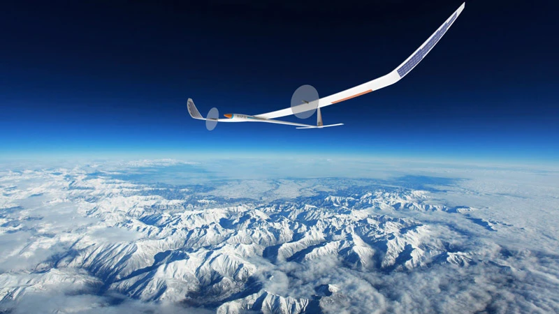
More test flights are planned for the following years, before HAP-alpha flies to the stratosphere for the first time in 2027. For that flight, the platform will be fitted with additional solar cells: while the prototype is equipped with only one square meter of photovoltaics, the “second expansion stage” will have 12 square meters of gallium arsenide cells on its wings. The electricity these generate will enable the platform to transport a load of five kilograms to an altitude of 20 kilometers. “That doesn’t sound like much, but it’s enough to accommodate a miniaturized radar or a high-resolution camera system on board. Both systems are also being developed as part of the project,” Nikodem says. “For future industry partners, this project presents a unique opportunity to test sensors and technologies for Earth observation and telecommunications in real conditions.”


